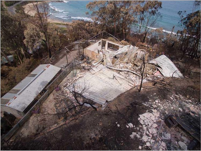
news In what it claims is a first in Australia, Insurance Australia Group (IAG) has used drones to examine damage caused by devastating bushfires and fast-track the assessment process for customer claims.
Mobilising the drone technology in the Great Ocean Road area of Victoria allowed the insurer to inspect properties before physical access was granted by authorities and consequently start processing customer claims immediately.
Aerial imagery shot by the drones in conjunction also meant both assessors and customers could review damage from a safe location, removing the risks associated with physical site visits such as asbestos, fallen power lines and land slips, IAG said.
“The impact caused by the Victorian bushfires was incredibly stressful for the homeowners affected and using drone technology as part of our assessment process allowed us to make the experience safer, simpler and faster for our customers,” said Andy Cornish, Chief Operating Officer for IAG.
Cornish added that IAG had received “extremely positive” feedback from customers who had benefitted from this technology.
“We are already working with our property repair partner to develop how we can use this technology to help more customers in the future,” he said.
IAG stressed that it worked with the Country Fire Authority (CFA) throughout the process to ensure the use of drones would not impair fire fighting efforts.
In addition to aerial assessment, the insurer said it is providing a range of support to customers in the affected area through its CGU Insurance brand, including mobile customer service, technical assistance with for customers who choose to manage the rebuilding process, emergency accommodation assistance and more.
“While technology has played a huge role in meeting our customers’ needs, we also understand that nothing beats personal connection when times are tough. We have allocated extra resource to ensure we have a team available on-the-ground to support our customers in getting back on their feet,” said Cornish.
Image credit: IAG

Hopefully some of that drone action comes our way over here on the West, what with Yarloop almost completely wiped off the map and Harvey and other areas still in danger, would certainly make it easier for home owners and insurers to assess the damage caused.
Comments are closed.